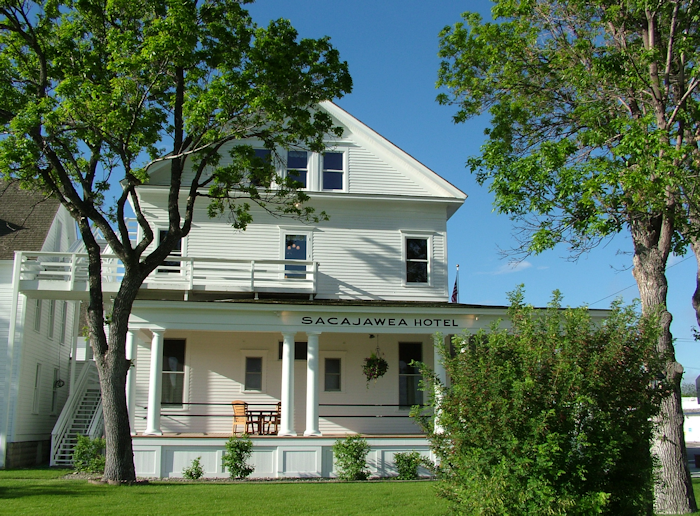
I spent the night at the appropriately named Sacajawea Hotel, which is a lovely building on the National Historic Register.
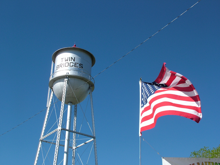
My first stop was the town of Twin Bridges, which required another decision from Lewis & Clark as once again the river forked. They explored the various channels although Lewis was confident that the Beaverhead was the right one. They faffed about for a while here – not helped by a beaver apparently stealing a note with instructions that Lewis left for Clark. I don’t know how they knew a beaver took it. One of the Corps was almost crushed by a capsized dugout canoe as Clark’s team backtracked downstream. All in all, the area was problematic.
All I wanted in Twin Bridges was an espresso. Now of course normally that would be a bit of a long shot (geddit) in a small town, but here was the Jumping Trout Espresso Bar. Result. “I’d like an espresso please,” I asked the woman in the little cabin. “Sure, an Americano,” she replied. “No, an espresso. Thanks”. “Yes, an Americano, with water”. “No, not the water, just the espresso.” “Wow! You must really need the caffeine hit”. “Um. Yes.” And what I got was a very nice, properly made espresso – albeit served in a gigantic paper cup. Next stop Dillon.
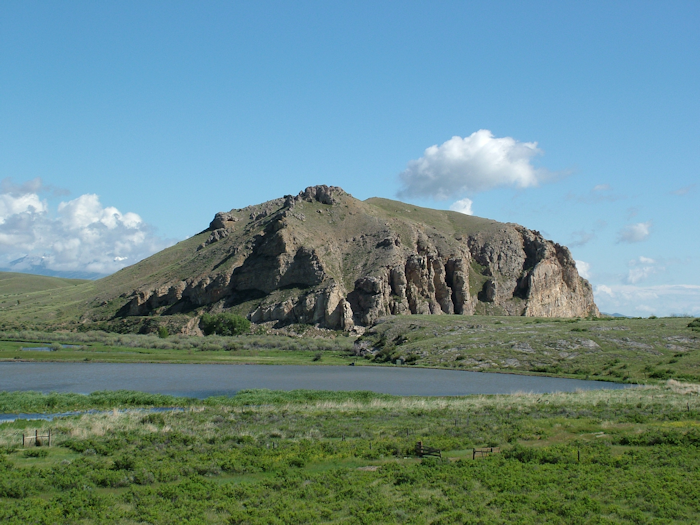
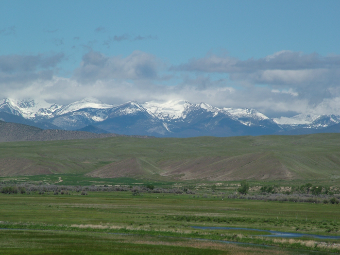
Actually, the next stop was Beaverhead Rock. This large outcrop was what Sacagawea recognised as the Corps made their way upriver. She remembered it from her childhood (which lets face it, wasn’t that far back) and this meant that they were on track, and near her Shoshone tribe. Why beaverhead rock? You mean you can’t see the resemblance? No. Me neither, although apparently this is the best angle. Although the view of the mountains is more impressive!
Dillon was attractive – it’s actually a college town – and the woman in the very well-stocked tourist office was very chatty and helpful, using that great rural American phrase of “It was nice to visit with you”, meaning it was nice to talk to you. Which always makes me think of Little House on the Prairie or some such folky idyll.
What I really wanted to know from her was whether I could tackle the Lemhi (the “hi” is as in the greeting, not as in “he”) Pass. This was the route over the continental divide that the expedition took, but the more I read about it the more it sounded like a challenging drive and given all the wet weather over the past couple of weeks I was getting a little nervous about it. Getting stuck in the middle of nowhere was far from an attractive proposition.
She looked skeptical when I said I only had an ordinary car. “We don’t normally advise people to go over before June 15 because of the snow,” she said. “It’s past mid-June, but with the weather I don’t think I’d want to tell you to do it.” Was my fate sealed? There were other ways of getting over the divide and into Idaho after all. She sold me on a trip to Bannack – a ghost town nearby that’s a popular stop off on the easier route. I suggested asking the Forest Service and she agreed that was a good idea.
“Is it a new Camry?” asked the ranger at the Forest Service. “Oh, well, you’ll be absolutely fine. You definitely won’t get stuck. You might want to take the longer route down the Idaho side, ‘cos the shorter route is quite steep, but you’ll be fine. Just stick the car in a low gear.” She was so blasé about it I was wondering whether we were even talking about the same route given the doom and gloom merchants in the guidebooks.
Heading off, I passed Camp Fortunate – or at least an overlook over a lake that now covers the site. Lewis had found the Shoshone after a few false starts, and at Camp Fortunate Clark finally rejoined them. The Shoshone were interested in trading horses for some of the Corps’ goods, but although relations were amicable things weren’t progressing that smoothly. Then two things happened – firstly a Shoshone woman recognised Sacagawea. They had both been kidnapped by the Hidasta, but the other woman had escaped. They had an emotional reunion. The second thing was more surprising. As the captains negotiated with Shoshone leader Cameahwait, Sacagawea recognised him. He was her brother.
This naturally eased the dealmaking (although apparently not as much as one might have thought) and
Lewis, Clark and the gang got their horses. The whole story is a lot more complicated than that inevitably, but you get the idea.
So, back to the road. Yeah. That was easy. Next.
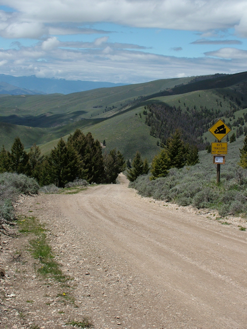
Oh you want more details? The road up is compacted dirt and perfectly easy to drive. The main obstacles (as a warning sign suggests at the start of the route) are livestock. This is ranching country and the cattle don’t seem too constrained by fences.
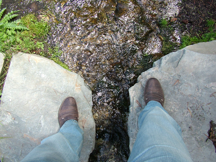
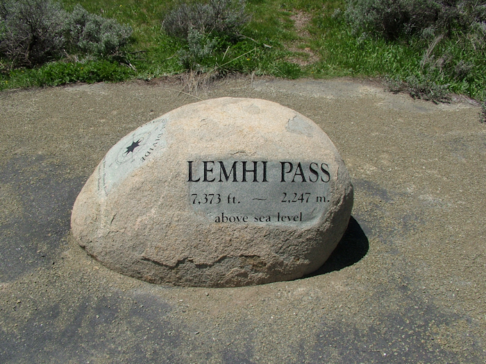
It didn’t take long to reach the pass. Just before the summit there’s a turnoff where you can go and bestride the mighty Missouri. Sort of.
There’s a spring that historians believe Lewis was referring to as “the most distant fountain” of the Missouri, “in search of which we have spent so many toilsome days and restless nights. I had accomplished one of those great objects on which my mind has been has been unalterably fixed for many years.” I naturally had to succumb to the photo opportunity.
Lewis and his small group actually made it right down to the valley floor in Oregon Territory where they made contact with the Shoshone before schlepping back over the pass to meet up with Clark as mentioned.
Making it down to the valley floor in what is now Idaho was slightly trickier than the road up. But
only slightly. It was quite steep and a bit rockier early on, but still nothing to worry a half-decent car. Cows again blocked the road and, slightly more worryingly, horses at one point.
The icy clear waters of this valley find their way to the Pacific. I had crossed the Continental Divide and left one of the world’s great river drainage systems.
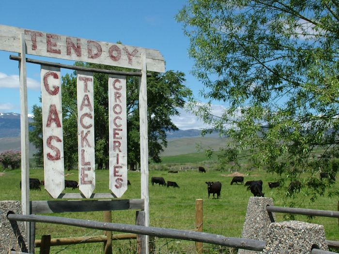
The Idaho road has several historical markers showing where Lewis and team camped on their way down the valley. The road emerges at the hamlet of Tendoy. Tendoy’s general store and post office was a throwback to a distant era – or rather the woman who worked there was. Quite literally. She happily told me that she and her sister had fed the construction crews who’d turned the railroad into the highway that I was about to drive on. Just after the war. She also told me where Sacajawea was born (just down the road, but on private property now).
Quite a bit further down the road was the Sacajawea Cultural Center, which was supposed to be open but seemed closed. I moved on. This bit of Idaho was horse country. Between the towns, every dwelling appeared to be a ranch and there were lots of horses as well as cattle. If you want modern cowboys, seems like this is the place to find them.
The road wound up again to the Lost Trail Pass, itself just shy of the continental divide. From here it was downhill for the Corps of Discovery. And they were suffering. The weather had been atrocious and food had become almost impossible to find. All their supplies were finished, their clothing and especially footwear was falling apart and unsuitable for both the climate and steep terrain, which was vastly different from anything they had faced on their journey from St Louis. Horses slipped down the steep hillsides.
In trying to ascertain the best route, the Corps had split up and scouted the various options. But with food so thin on the ground, every extra mile was costly. The bartering for horses wasn’t just about transport – they were also walking meals. It was only August, but winter was coming early. The local Indians were forced to rein in their generosity and trade for salmon rather than donating it to the hungry expedition.
Finally, they came off the mountain back into what is now Montana and killed a deer. Their first real meal for days. Once again, it is astonishing that not a single member of the expedition, including Sacajawea and her infant son, perished on this trek of starvation. Near Sula they met 400 Salish Indians who shared what little food they had.
Having covered in a day what took L&C over a month – a month that almost finished them off – it was hard to appreciate the dread that must have filled their hearts when they saw the western range of Bitterroot Mountains that still stood between them and the Pacific. These steep jagged peaks, indistinct amid the cloud as I drove down the valley are a far cry from the domed tops they had mostly confronted thus far. They camped near Hamilton, the largest town in the valley and my home for the next day as well. We were both heading for the Lolo pass – the only way west out of the valley.
Marvelous travelogue. Thanks for sharing your trek. Sorry to hear the Sacajawea Center was closed. When do you get to Lewiston? Would love for you to meet with Farren Penney of the Nez Perce Tribe if you have time.
Karen Ballard, Administrator Idaho Tourism
karen.ballard@tourism.idaho.gov