From Great Falls the snow-capped mountains started to come into view. A small taster of what was to come. The Missouri adventure was coming to an end, but the Corps – and me – was still a long way from the Pacific coast.
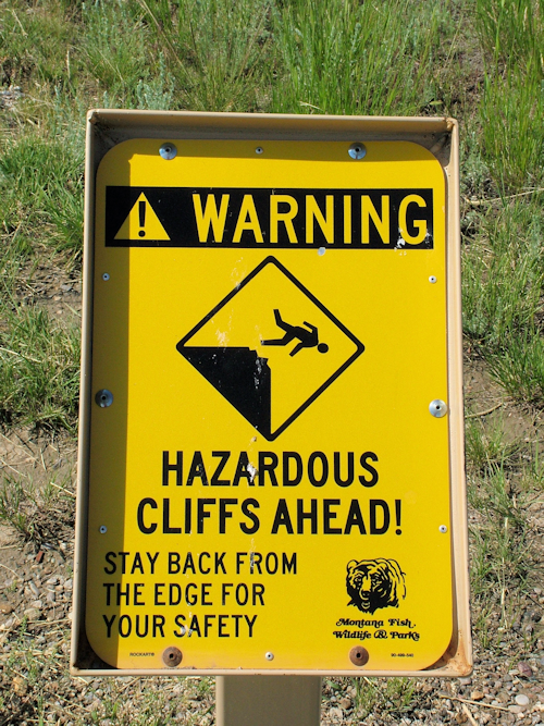
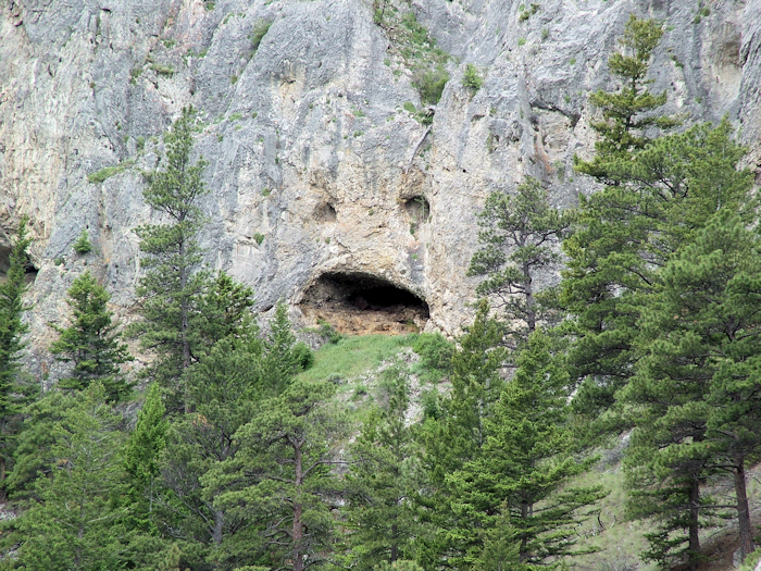
The first stop didn’t have much L&C relevance. The First People’s Buffalo Jump state park is a cliff that the local Indians (the Blackfeet and Crow in these parts) used to force buffalo over.
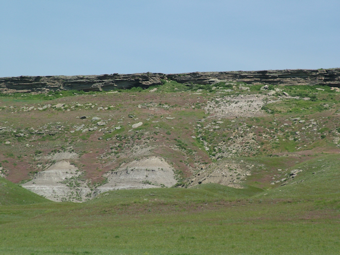
This wasn’t as easy a way to kill them as you might think – it was quite an artform, if a little heavy-handed. I walked up to the top of the hill where now a helpful sign warns visitors of the impending danger.
You get the point. The top of the cliff is now (and maybe was in the 16th century, when this jump site stopped being used) a prairie dog town. You can get surprisingly close to them.
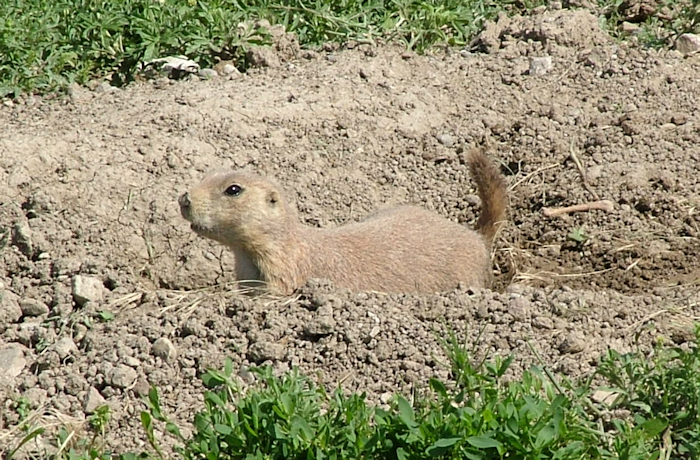
I managed to avoid getting surprisingly close to one of these.
The hazy view from the top was rather good – snow-capped mountains in the distance – a taster of what the Corps was going to face – and what I still had to negotiate following their path as closely as was feasible (hint: they didn’t take the interstate).
I actually DID take the interstate next. I’d generally managed to avoid them, but I-15 was both the best way to get to my next destination, and is the closest road to the river. This was a real transition leg, moving from the plains of Ulm – where the buffalo jump was – to the mountains. The road wound up, corkscrewing through the foothills with some amazing views that I couldn’t really see as I hugged the tight corners climbing up and up.
My next stop was at Gates of the Mountains on the Hilger property. Boat tours run a few miles downstream from the marina through the limestone canyon that so impressed Lewis (Clark never saw this rather special bit of riverscape). Moving up into the mountains also meant another big change. Suddenly there were tourists – something I hadn’t seen much of since St Louis.
I bought my ticket for the boat tour in the rather retro café/souvenir shop and heard an Aussie accent. An English couple were apparently on the boat trip that was on the river then (I spotted them a mile off when they disembarked), and a weird combo of a Vietnam vet (I guessed, but he also managed to mention it before too long) and his wife who was ethnically Japanese, and their two Swiss guests. I could imagine how this had come about – no doubt the Americans had been to Switzerland once – they probably met on a boat on Lake Lucerne and before the Swiss knew what had hit them they were being invited to Montana. I tried to engage Hans in conversation but it turned out that his wife had the English and I couldn’t be bothered to get into the whole German thing.
The Gates of the Rocky Mountains, as Lewis termed them, refer to two cliffs either side of the river that appear to block the course of the Missouri before “opening” to reveal the path forward. Or closing in the video.
It was Fathers Day, and the trip was popular. We had commentary from Kyle, who was pretty good although most people weren’t listening to his geological explanations – they preferred the “see if you can see the monster in the rocks”.
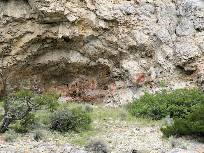
Lewis described the canyon as “the most remarkable cliffs we have yet seen”. They are indeed impressive, rising some 1200 feet above the river. They are good for wildlife spotting, although a mule deer and a couple of bald eagles was all we could muster. I was hoping for a mountain goat and black bears had also been spotted recently. We did see some Indian pictograms, but they’re not actually that old – 1200 years rather than many thousand.
Clark meanwhile was travelling overland to try and find the Shoshone people who the Corps was trying to locate in order to obtain horses with which to cross the Rockies. It would be some time before they accomplised this.
The boat normally stops at Meriwether picnic site, but it was flooded out. Which isn’t common and is a big problem. The Colter campground has only just reopened after being destroyed a few years ago.
Aside from Lewis & Clark, the other big story around here is that of the Mann Gulch fire. It’s a very sad story, and I think rather freaked out some of the younger children on the boat. I won’t tell the story, but it’s worth reading. Seeing the actual hillside really does bring it horribly to life.
After docking, I bolted for the car as I had still had a bit of driving to do to get to my iconic destination for the day – the headwaters of the Missouri. Driving into Helena (the state capital of Montana) I could see an astonishing black cloud ahead with rain very heavily concentrated on one spot. And lightning.
Inevitably my route and the weather coincided. It wasn’t the thunderstorm experience of Missouri two weeks earlier, this time it was hail. Large hailstones smashing into the windscreen and bouncing loudly off the roof. Finally it forced most traffic, including me, off the road. It only lasted about 10 minutes, but was another reminder of the intensity with which storms can strike here. Little did I know at the time, that only 100 miles down the road the worst Montana tornado in 50 years was wiping out parts of downtown Billings (the state’s biggest city).
Within 15 minutes, I was on bone dry roads heading towards Three Forks. The Missouri Headwaters State Park covers the area where the three similar-sized tributaries merge to form the Missouri. Lewis & Clark named them after the prominent politicians of the day: President Jefferson, Secretary of State Madison and Secretary of the Treasury Gallatin. The Madison (foreground) and Jefferson (coming in from the top) merge first, and this is when officially the Missouri begins.
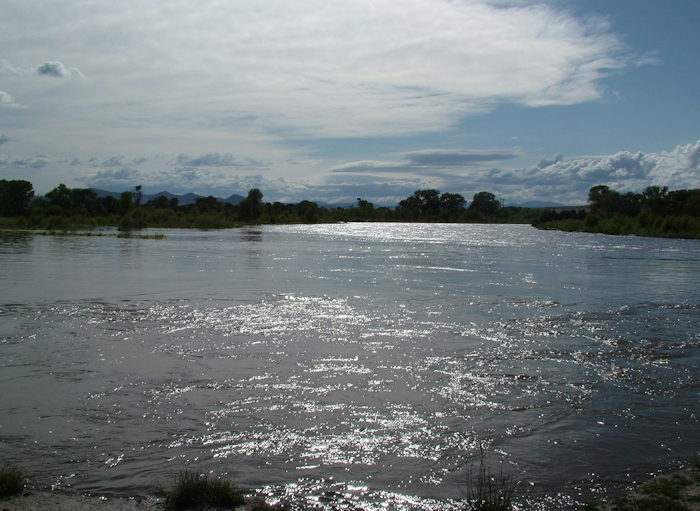
Lewis & Clark die-hards don’t classify it as such until the Gallatin merges with these two about half a mile downstream. The whole area is a flat plain of braided channels and it’s hard to see which meander goes where.
Having reached this pivotal point of the trip – some 2,500 miles upstream from Missouri – the men were clearly exhausted. One suspects that there was a psychological release at this point. Even Clark was a wreck after days of walking – in fact he reached the spot first on his hunt for the Shoshone. He also saved the life of Charbonneau (Sacajawea’s husband) who couldn’t swim.
The group rested at this very pleasant spot for a couple of days to help them all recover. They were, however, more or less lost and starting to panic about the invisible Shoshone Indians. Without their horses the expedition was completely stuck, with mountains all around them and no clue as to what lay ahead.